The Plan
Photo by Jerry Monkman, courtesy of Southeast Land Trust of New Hampshire
Spanning 52 communities across New Hampshire and Maine, the coastal watershed is the geographic area that drains into the Atlantic Ocean from the Piscataqua River, the Hampton-Seabrook Estuary, and the coastline in between. New Hampshire's Coastal Watershed Conservation Plan identifies high value natural resources and conservation lands that are essential to the resilience of watershed communities. It includes mapping products that identify land conservation priorities to support climate resilience, wildlife management, landscape connectivity, working landscapes, recreation, and clean water. The Plan is a tool everyone can use to protect our most important lands and natural resources, while balancing the need for economic growth and development. This website was created to help share the Plan and other conservation resources with the region's communities and the professionals who support them. Read this two-page factsheet or watch this 20-minute overview presentation to learn more about the Plan.
Why Protect?
An acre a day. That’s how quickly we are losing natural lands in the coastal watershed to development. From the headwaters of the Salmon Falls River, to the salt marshes of Hampton and Kittery, 52 communities depend on these lands to keep drinking water clean, reduce flooding hazards, provide wildlife habitat, support local farms and other businesses, and create opportunities for hunting, fishing, and sustainable recreation.
Now is the Time. As our climate becomes hotter, drier, and stormier, the value and cost of protected land will only increase. We need to act now to permanently protect the lands that conserve our critical natural resources before we lose them. By allowing room for nature to respond and adapt to the change in climate, we also will help people better protect their homes and businesses. Learn more about communicating the value of natural resources in the context of conservation work.
Permanent protecting land is not enough. Permanent land conservation is an important strategy to manage and protect priority lands into the future. However, we also need to integrate conservation priorities from the Plan into land use planning, public policy, and outreach efforts that support protection of our natural resources. Learn more about communicating the value of conservation.
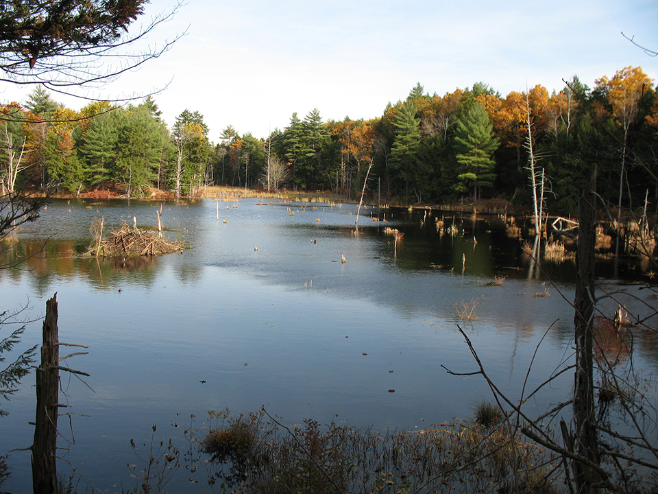
Photo: D. Brickner-Wood
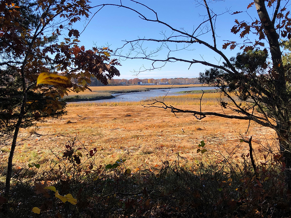
Photo: Amanda Stone
About the Plan
The New Hampshire Coastal Watershed Conservation Plan is the product of a collaboration between The Nature Conservancy in New Hampshire and its partners. An update to an earlier (2006) version, the Plan draws on the 2020 Wildlife Action Plan, wildlife corridors, saltmarsh studies, the Water Resources Supplement to the 2006 Coastal Plan and many other efforts to characterize this watershed.
The Plan identifies conservation values and goals that are important to watershed communities. These closely align with the conservation and stewardship goals of the Great Bay Resource Protection Partnership, which initiated and supported Plan development. The Plan leverages existing datasets that are aligned with these values and goals to identify a prioritized set of Conservation Focus Areas and Priority Agricultural Resources. Most of the lands captured by these datasets support recreational and education opportunities even though these values are not categorized individually.
The importance of each dataset was weighted and ranked based on its ability to support conservation goals. This analysis identified critical conservation areas and those with multiple conservation values. Learn more about how the Plan was developed.
Time for Progress
The Plan has set a goal of conserving 4,000 acres annually! This is an ambitious goal to meet an urgent need—to protect the natural places that protect our homes, support our businesses, and underpin our quality of life. Permanent conservation helps significantly to lessen the impacts of climate change and development. In the process, it helps provide for clean drinking water, local food production, and wildlife habitat.
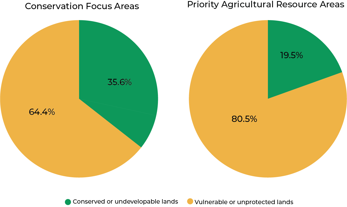
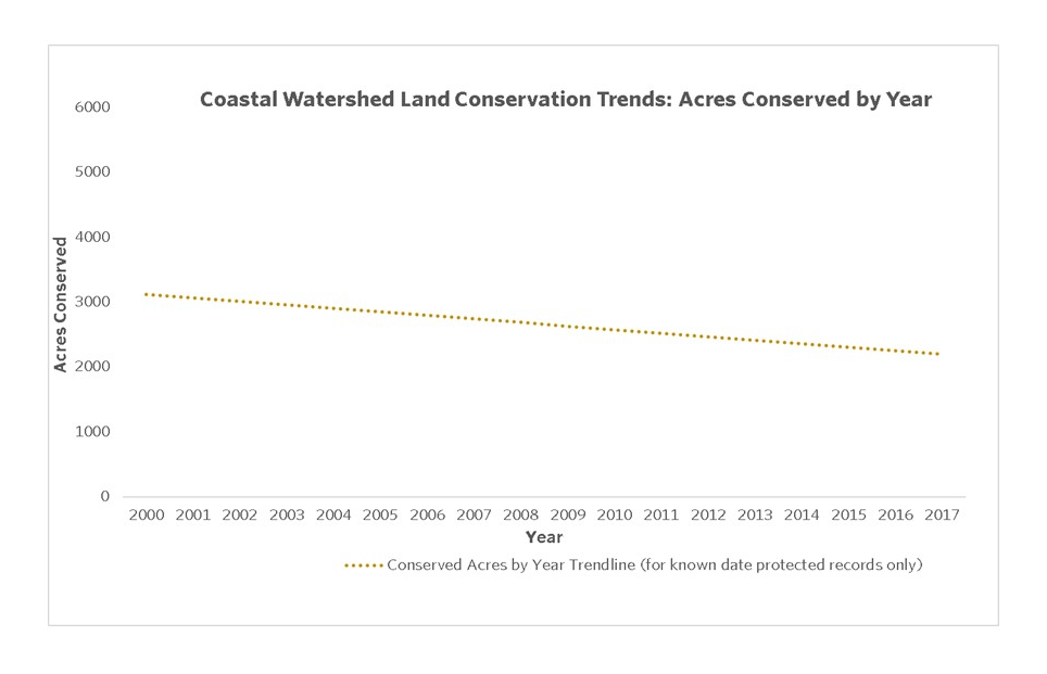
Across the coastal watershed, the rate of land protection is declining. Only 2,100 acres were conserved in 2017, down from 3,100 in 2000. The Plan provides clear guidance for where our future conservation efforts are most needed. The Coastal Conservation Focus Areas it identifies cover 38.2% of the watershed. As of 2021, 75,165 acres of this land had been conserved, leaving 170,813 acres vulnerable or unprotected.
Agricultural and working lands are small but important piece of our natural and cultural landscape. The Plan identifies Coastal Priority Agricultural Resources that cover 4.7% of the watershed. By the end of 2021, only 6,344 acres were conserved, leaving 26,218 acres unprotected.
The Team
Staff from the following organizations helped develop the Plan and the associated outreach products. They are committed to advancing conservation priority goals in partnership with local communities throughout New Hampshire’s Coastal Watershed. Learn how these and other organizations can support your conservation efforts.